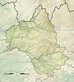
Dosiero:Aveyron department relief location map.jpg
Aspekto

Grandeco de ĉi antaŭvido: 541 × 600 rastrumeroj. Aliaj distingivoj: 216 × 240 rastrumeroj | 433 × 480 rastrumeroj | 693 × 768 rastrumeroj | 924 × 1 024 rastrumeroj | 1 310 × 1 452 rastrumeroj.
Bildo en pli alta difino ((1 310 × 1 452 rastrumeroj, grandeco de dosiero: 2,05 MB, MIME-tipo: image/jpeg))
Dosierhistorio
Alklaku iun daton kaj horon por vidi kiel la dosiero tiam aspektis.
| Dato/Horo | Bildeto | Grandecoj | Uzanto | Komento | |
|---|---|---|---|---|---|
| nun | 15:17, 24 jun. 2016 |  | 1 310 × 1 452 (2,05 MB) | Flappiefh | Thicker borders. |
| 15:10, 24 jun. 2016 |  | 1 310 × 1 452 (2,05 MB) | Flappiefh | User created page with UploadWizard |
Dosiera uzado
La jenaj paĝoj ligas al ĉi tiu dosiero:
Suma uzado de la dosiero
La jenaj aliaj vikioj utiligas ĉi tiun dosieron:
- Uzado en fr.wikipedia.org
- Villefranche-de-Rouergue
- Maleville
- Najac
- Causse du Larzac
- Espeyrac
- Saint-Félix-de-Sorgues
- Laguiole (Aveyron)
- Tournemire (Aveyron)
- Roquefort-sur-Soulzon
- Conques
- Millau
- Rodez
- Saint-Affrique
- Camarès
- Sylvanès
- La Bastide-Pradines
- Calmels-et-le-Viala
- Saint-Izaire
- Saint-Jean-d'Alcapiès
- Salles-la-Source
- Bozouls
- Saint-Rome-de-Cernon
- Vabres-l'Abbaye
- Versols-et-Lapeyre
- Rodelle
- Muret-le-Château
- Abbaye de Loc-Dieu
- Martiel
- Decazeville
- Montclar (Aveyron)
- Nant (Aveyron)
- Saint-Jean-et-Saint-Paul
- Creissels
- Lacalm
- Sévérac-le-Château
- Arnac-sur-Dourdou
- Espalion
- Saint-Chély-d'Aubrac
- Sainte-Eulalie-d'Olt
- Sainte-Radegonde (Aveyron)
- La Capelle-Bleys
- Signal de Mailhebiau
- Agen-d'Aveyron
- Aguessac
- Les Albres
- Almont-les-Junies
- Alpuech
- Alrance
- Ambeyrac
- Anglars-Saint-Félix
Vidi plian ĝeneralan uzadon de ĉi tiu dosiero.

