
Dosiero:Elkader Keystone Bridge.jpg
Grandeco de ĉi antaŭvido: 768 × 599 rastrumeroj. Aliaj distingivoj: 308 × 240 rastrumeroj | 615 × 480 rastrumeroj | 984 × 768 rastrumeroj | 1 280 × 999 rastrumeroj | 2 560 × 1 998 rastrumeroj | 4 343 × 3 389 rastrumeroj.
Bildo en pli alta difino ((4 343 × 3 389 rastrumeroj, grandeco de dosiero: 1,3 MB, MIME-tipo: image/jpeg))
| Jen dosiero de la Wikimedia-Komunejo. La priskribo en ties priskriba paĝo estas montrata suben.
|
|
This is an image of a place or building that is listed on the National Register of Historic Places in the United States of America. Its reference number is 76000747. |
| Pozicio de la fotilo | | Tiu cxi bildo kaj pliaj sur OpenStreetMap |
|---|
| Priskribo |
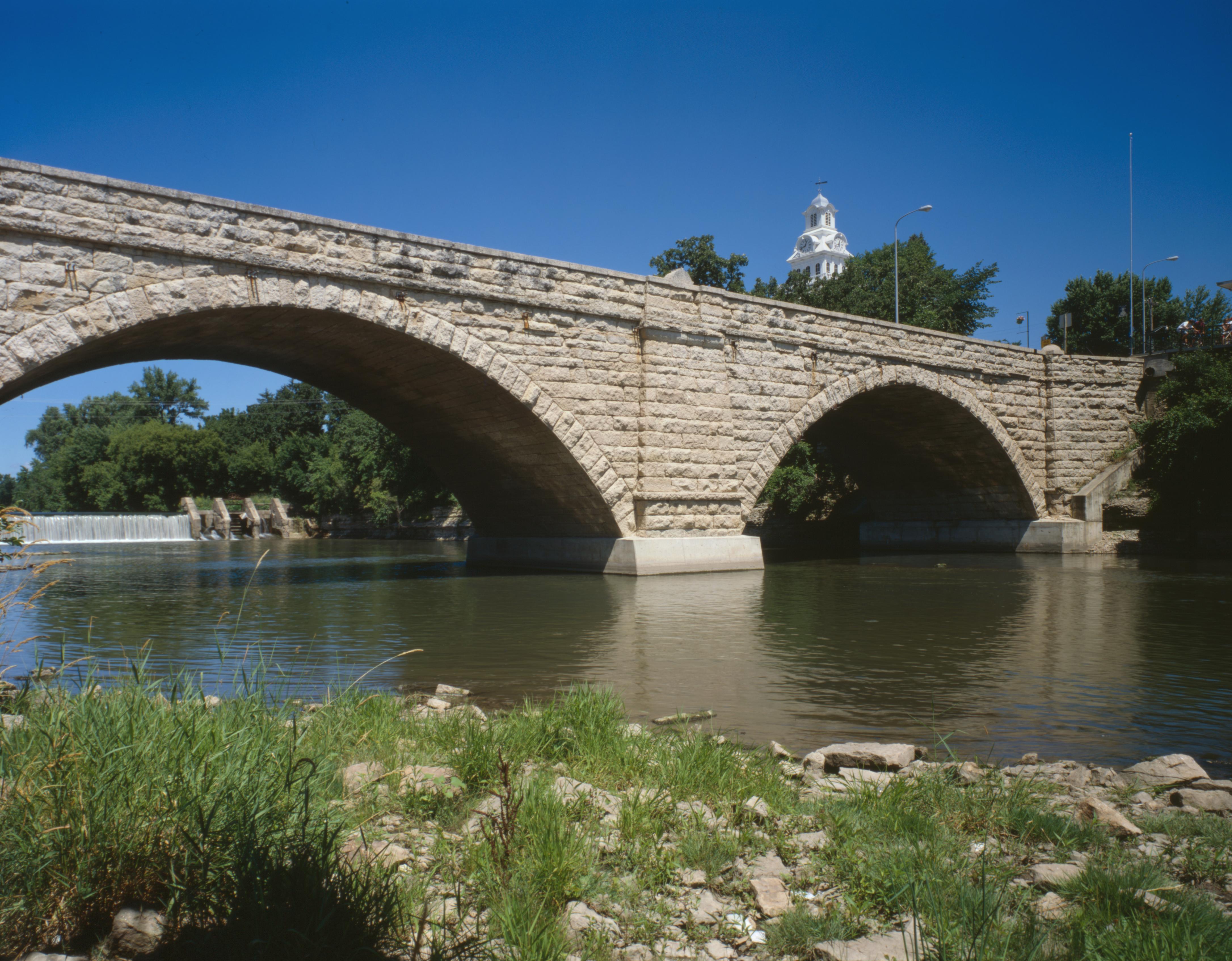
English: Southern (downsteam) side of the Elkader Keystone Bridge, which carries Bridge Street over the Turkey River at Elkader, Iowa, United States. Built in 1888, it is listed on the National Register of Historic Places. Note the tower of the Clayton County Courthouse, also Register-listed, in the background. |
||||
| Dato | somero 1995 | ||||
| Fonto | Library of Congress, Prints and Photograph Division HAER: IA-47-9 | ||||
| Aŭtoro | Joseph Elliott | ||||
| Permeso (Reuzo de la dosiero) |
|

|
This image is available from the United States Library of Congress's Prints and Photographs division
under the digital ID hhh.ia0423. This tag does not indicate the copyright status of the attached work. A normal copyright tag is still required. See Commons:Licensing.
|
Dosierhistorio
Alklaku iun daton kaj horon por vidi kiel la dosiero tiam aspektis.
| Dato/Horo | Bildeto | Grandecoj | Uzanto | Komento | |
|---|---|---|---|---|---|
| nun | 21:53, 31 maj. 2009 | | 4 343 × 3 389 (1,3 MB) | Cropbot | upload cropped version, operated by User:Finavon. Summary: border cropped |
| 11:32, 30 maj. 2009 |  | 4 706 × 3 765 (1,49 MB) | Nyttend | {{Location|42|51|17|N|91|24|13|W}} {{Information |Description={{en|Southern (downsteam) side of the {{w|Elkader Keystone Bridge}}, which carries Bridge Street over the {{w|Turkey River (Iowa)|Turkey River}} at {{w|Elkader, Iowa|Elkader}}, {{w|Iowa}}, {{w| |
Dosiera uzado
La jena paĝo ligas al ĉi tiu dosiero:
Suma uzado de la dosiero
La jenaj aliaj vikioj utiligas ĉi tiun dosieron:
- Uzado en ar.wikipedia.org
- Uzado en arz.wikipedia.org
- Uzado en bn.wikipedia.org
- Uzado en de.wikipedia.org
- Uzado en en.wikipedia.org
- Uzado en es.wikipedia.org
- Uzado en fr.wikipedia.org
- Uzado en it.wikipedia.org
- Uzado en pt.wikipedia.org
- Uzado en www.wikidata.org