
Dosiero:Karte Strassenbahn Biel 1925.png
Grandeco de ĉi antaŭvido: 800 × 481 rastrumeroj. Aliaj distingivoj: 320 × 192 rastrumeroj | 640 × 385 rastrumeroj | 1 024 × 616 rastrumeroj | 1 515 × 911 rastrumeroj.
Bildo en pli alta difino ((1 515 × 911 rastrumeroj, grandeco de dosiero: 2,64 MB, MIME-tipo: image/png))
| Jen dosiero de la Wikimedia-Komunejo. La priskribo en ties priskriba paĝo estas montrata suben.
|
Resumo
| Priskribo |
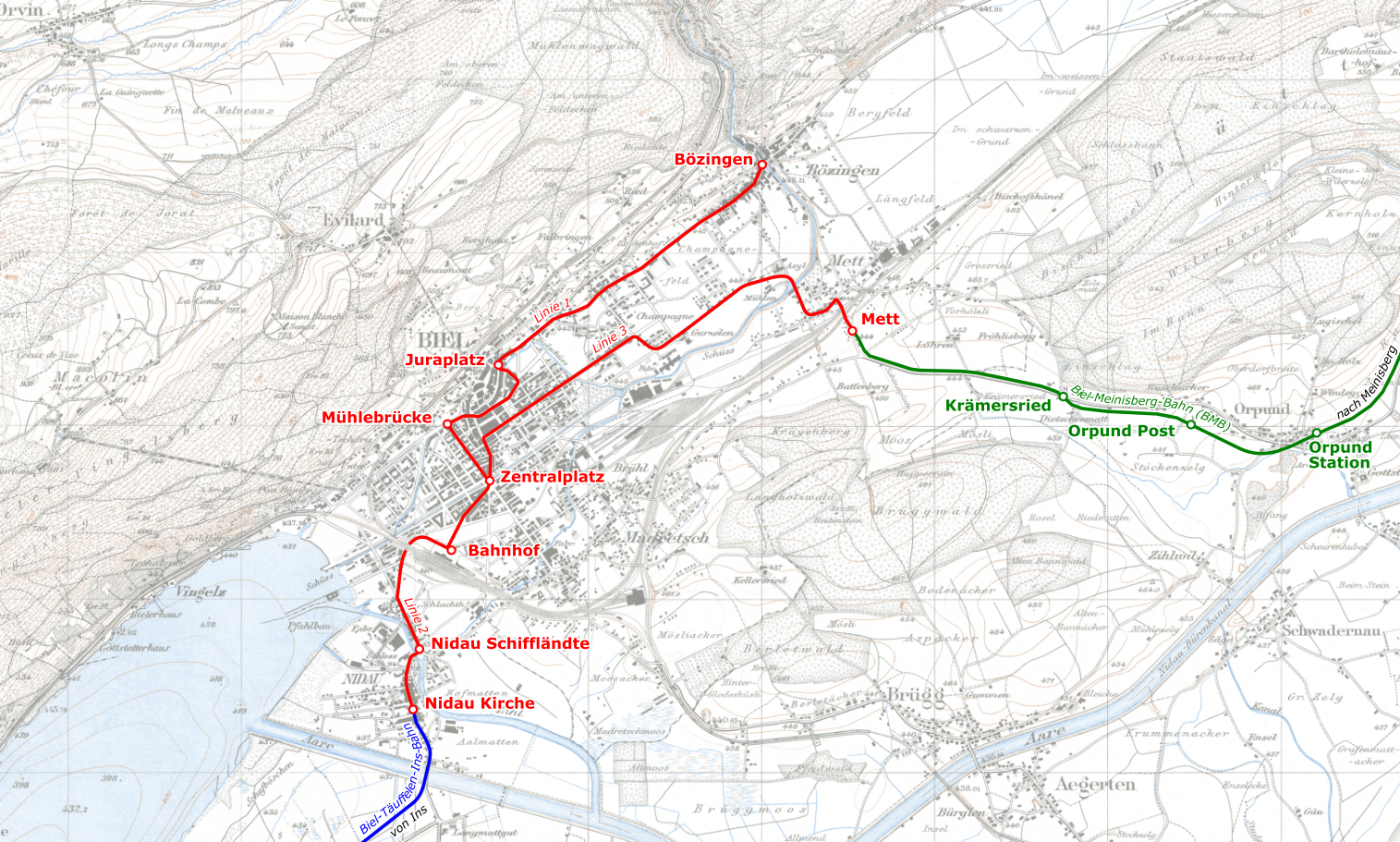
Deutsch: Linien der Strassenbahn Biel im Jahre 1925 |
|||||||||
| Dato | ||||||||||
| Fonto | ||||||||||
| Kreinto |
|
|||||||||
| Permeso (Reuzo de la dosiero) |
|
|||||||||
| Geotemporal data | ||||||||||
| Bounding box |
|
|||||||||
| Georeferencing | ||||||||||
Dosierhistorio
Alklaku iun daton kaj horon por vidi kiel la dosiero tiam aspektis.
| Dato/Horo | Bildeto | Grandecoj | Uzanto | Komento | |
|---|---|---|---|---|---|
| nun | 12:02, 16 jan. 2020 | | 1 515 × 911 (2,64 MB) | Pechristener | == {{int:filedesc}} == {{map |description={{de|Linien der Strassenbahn Biel im Jahre 1925}} |date=2020-01-16 |source= * Hintergrund: ** Siegfriedkarte, Blatt 121 ''Orvin'', 1925: [https://map.geo.admin.ch/] ** Siegfriedkarte, Blatt 124 ''Biel'', 1925: [https://map.geo.admin.ch/] * Strecken-Eintrag nach oben genannter Siegfriedkarten und Luftbilder [https://map.geo.admin.ch/] |author= * Siegfriedkarte: Eidgenössisches Stabsbureau (heute Bundesamt für Landestopografie) * Markierungen Tramlinie... |
Dosiera uzado
La jena paĝo ligas al ĉi tiu dosiero:
Suma uzado de la dosiero
La jenaj aliaj vikioj utiligas ĉi tiun dosieron:
- Uzado en de.wikipedia.org
- Uzado en www.wikidata.org