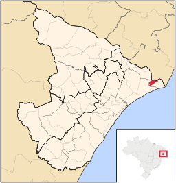
Ilha das Flores (Serĝipo)
Aspekto
| Ilha das Flores | |
| municipo | |
|
|
|
| Oficiala nomo: Ilha das Flores | |
| Lando | |
|---|---|
| Subŝtato | |
| Mezoregiono | Leste Sergipano |
| Mikroregiono | Propriá |
| Situo | urba centro |
| - koordinatoj | 10° 26′ 09″ S 36° 32′ 24″ U / 10.43583 °S, 36.54000 °U (mapo) |
| Areo | 54,639 km² (5 463,9 ha) |
| Loĝantaro | 8 348 (2010) |
| Denseco | 152,78 loĝ./km² |
| Horzono | UTC-3 |
| Retpaĝo: http://www.ilhadasflores.se.gov.br | |
Ilha das Flores estas municipo en la brazila subŝtato Serĝipo, kiu havis 8.348 loĝantojn en 2010 [1].
Vidu ankaŭ
[redakti | redakti fonton]Referencoj
[redakti | redakti fonton]- ↑ IBGE. Ilha das Flores (HTML). Censo 2010. Alirita 2011-12-27 .


